Perusahaan ini terdaftar sebagai Free Member. Hindari melakukan pembayaran sebelum bertemu penjual atau melihat barang secara langsung. COD (Cash On Delivery) atau bertemu langsung dengan penjual merupakan metode transaksi aman yang kami sarankan.
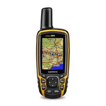
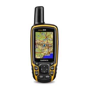
GPSMAP 64 features a 2.6" sunlight-readable color screen that supports BirdsEye Satellite Imagery (subscription required) and Garmin Custom Maps. Rugged and waterproof, GPSMAP 64 uses a quad helix antenna for superior reception.
Physical dimensions 2.4" x 6.3" x 1.4" (6.1 x 16.0 x 3.6 cm) Display size, WxH 1.43" x 2.15" (3.6 x 5.5 cm); 2.6" diag (6.6 cm) Display resolution, WxH 160 x 240 pixels Display type transflective, 65-K color TFT Weight 8.1 oz (230 g) with batteries Battery 2 AA batteries (not included); NiMH or Lithium recommended Battery life 16 hours Water rating IPX7 High-sensitivity receiver Interface USB and NMEA 0183 compatible
Basemap Ability to add maps Built-in memory 4GB Accepts data cards microSD™ card (not included) Custom POIs (ability to add additional points of interest) Waypoints/favorites/locations 5000 Routes 200 Track log 10,000 points, 200 saved tracks
Automatic routing (turn by turn routing on roads) Yes (with optional mapping for detailed roads) Geocaching-friendly Yes (Paperless) Custom maps compatible Hunt/fish calendar Sun and moon information Tide tables Yes (with optional Bluechart) Area calculation Picture viewer